Field Geomorphology
Research projects
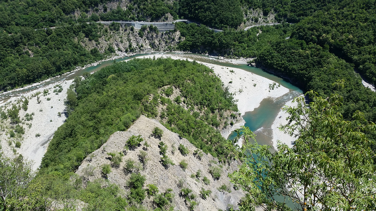
The Alps are one the best studied geological orogens in the world. However, fundamental questions remain unanswered. We approach the orogenic system in the context of the whole Alps-Apennines-Carpathians-Dinarides orogenic system. The AlpArray initiative implements new approaches and improved technology to increase our general understanding of large scale tectonic structures and surface processes. To obtain high resolution tomography and physical properties of deep structures, a European network of seismic stations was installed around the greater Alpine area. Lithospheric structures and surface topography are linked by isostasy and exhumation; thus both control the evolution of the orogenic system. Rivers and tectonics influence each other to shape the landscape. Additionally rivers connect the orogen with its surrounding basins and adjacent orogenic systems. River profiles can provide us an estimate of paleo-altimetry and reveal transient features in the landscape. River catchments have caused major changes in paleo topography that cannot be fully explained by tectonics, climate, or glaciation. We analyze drainage networks using field observations and models, and use cosmogenic nuclides to obtain spatial erosion rates and ages of geomorphic markers.
People
Dr. Sean Willett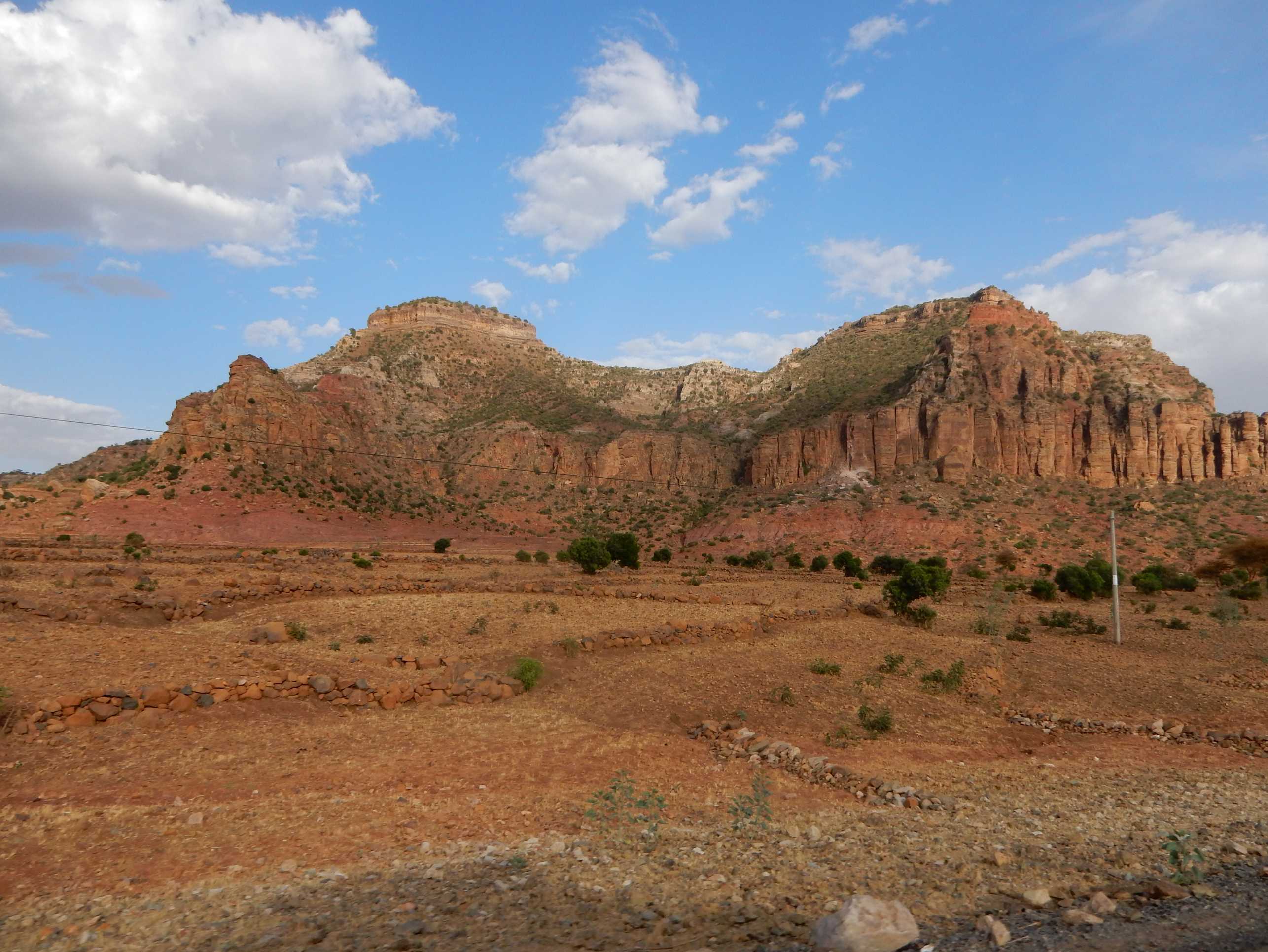
This is a collaborative project with the ETH Biogeoscience Group, using concepts in surface dynamics as well as organic biomarkers to answer larger-scale questions about the Ethiopian Plateau, Eastern Africa.
- Numerical modeling and 10Be cosmogenic nuclides allow us to investigate landscape evolution and rates of change in the study area.
- The structure and isotopic composition of organic molecular biomarkers help us reconstruct past changes in eco-hydrology and topography of the Plateau over the past 30 million years.
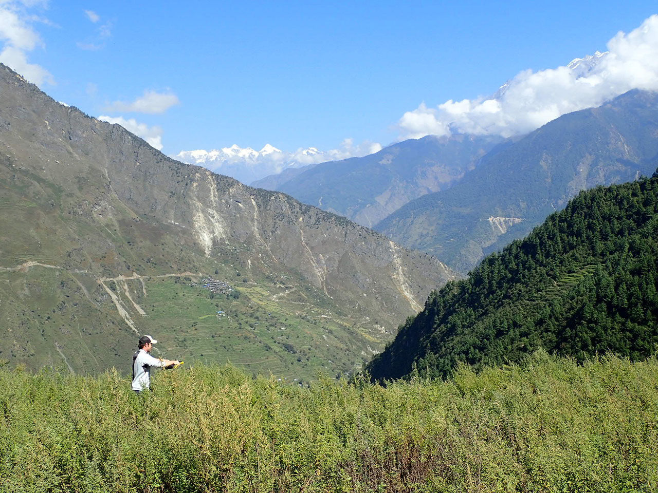
Large upper crustal earthquakes in mountainous settings can result in widespread and catastrophic mass-wasting. The Mw 7.8 Gorkha Earthquake caused tens of thousands of landslides in Central Nepal during the April, 2015 event. In this study, we are using the Gorkha Earthquake as a case-study to assess the role of coseismic landsliding on unsteadiness in long-term erosional budgets and sediment transport processes. We are using cosmogenic nuclide concentrations in fluvial detritus collected from Himalayan rivers to document spatial and temporal changes in erosion and sediment transport processes in the aftermath of the earthquake. In addition, computer models provide a further understanding of the ways in which large earthquakes effect the evolution of tectonically active mountains over geologic timescales. This work is in collaboration with the ETH Biogeoscience Group.
The island of Crete occupies a forearc high above the Hellenic Subduction Zone and is characterized by rapid and sustained uplift and extension. No active contractional faults are observed on the island today. Our working hypothesis is that rapid uplift of the island is driven by crustal thickening at depth, while extension occurs in the upper crust. The aim of this project is to document the rates of uplift, erosion, and extension on Crete by surveying and dating marine and river terraces, determining basin average erosion rates using cosmogenic radionuclides, and documenting slip rates on active faults.